Lake Tyler Maps
Lake Tyler (West) and Lake Tyler (East), located adjacent to each other and connected via a canal, are located just east of Tyler, Texas.
These are the largest lakes in the Tyler area in addition to Lake Palestine.
Lake Tyler (West), built in 1949, covers 2,224 surface acres and serves as the major source of water supply to the Tyler metro area.
Lake Tyler (East), completed in 1966, covers an additional 2,276 acres.
The maximum depth of the lakes is 40 feet. The conservation pool elevation is 375 feet above mean sea level.
Shown below is a map of the Lake Tyler area.
Map of Lake Tyler West and Lake Tyler East (courtesy of Google Maps)
![]()
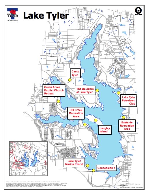
Detailed Lake Tyler map at the website of the City of Tyler
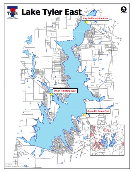
Detailed Lake Tyler East map at the website of the City of Tyler
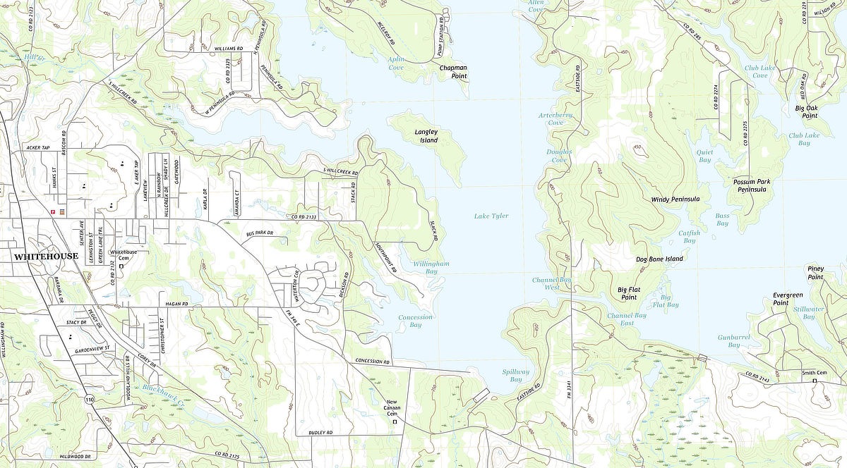
USGS TOPO Map of the Southern Sections of Lake Tyler and Lake Tyler East |


